3D Scanning
Industrial 3D laser scanning for as-built documentation, renovation and engineering projects
Capture your installation in full digital detail.
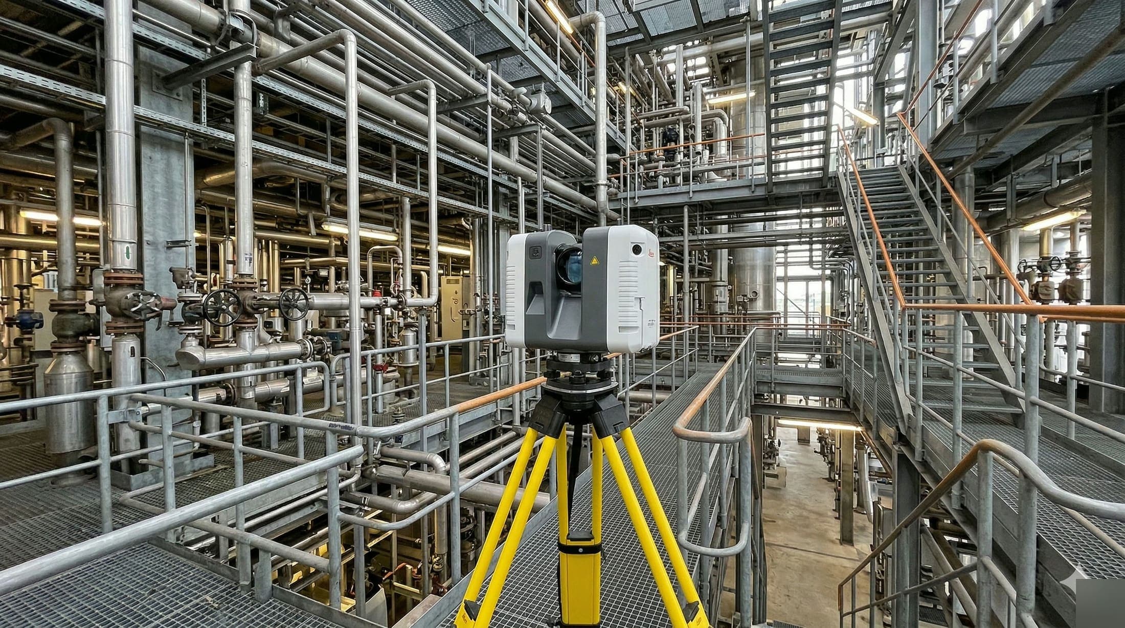
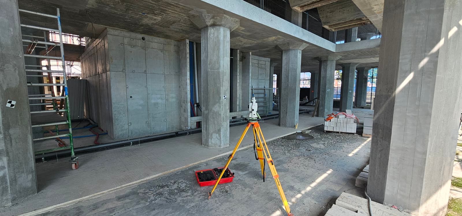
When renovating, expanding or maintaining industrial installations, current as-built information is essential. Drawings from ten years ago no longer match reality. Manual measurements take days and disrupt production. With 3D laser scanning you capture the entire existing situation in hours, not weeks.
The result is a detailed point cloud: millions of measurement points that together form a millimeter-accurate 3D representation of your installation. This data is immediately usable for engineering, clash detection, maintenance and as-built documentation. Your engineers work with reality, not with outdated drawings.
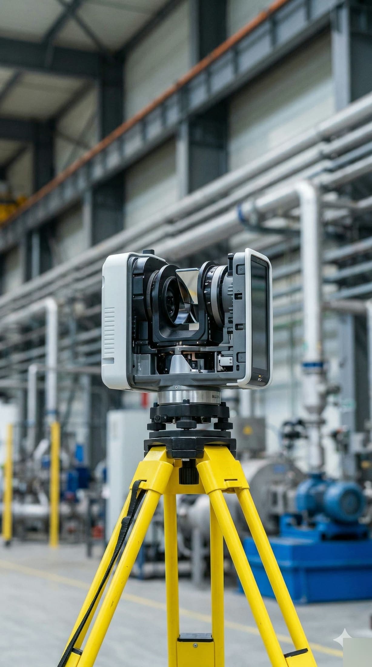
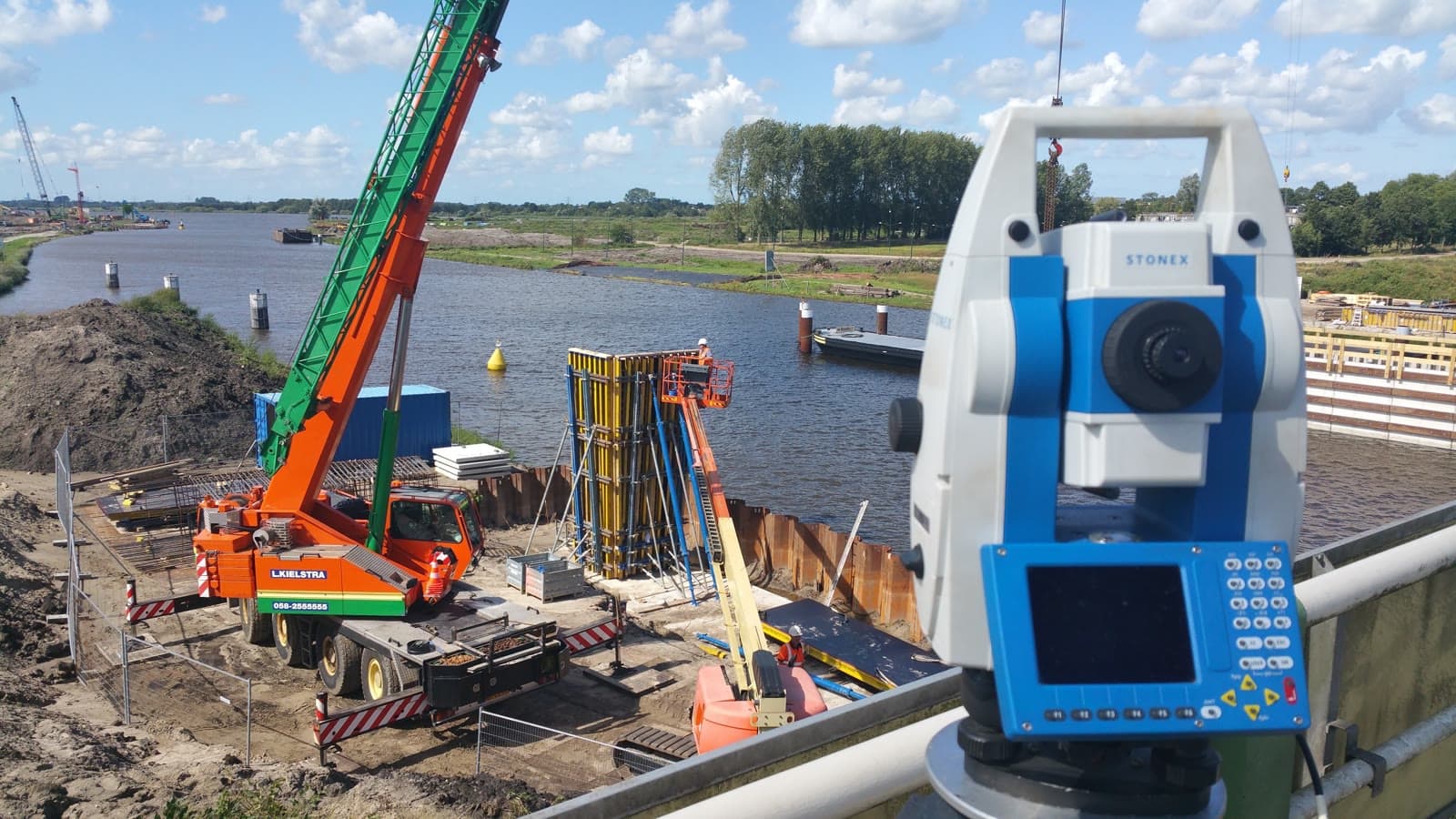
We scan with the NavVis VLX, a mobile 3D scanning system that captures large areas quickly without disrupting production. Combined with Leica measurement equipment for control points, this guarantees millimeter accuracy. We deliver the processed output in the format your engineering team needs: point cloud, CAD model, BIM or 2D drawings.
From petrochemical plants and refineries to offshore modules and power stations. We have experience with 3D scanning in complex, safety-critical environments and we understand the requirements that come with them.
Equipment & software
What you can expect.
Point cloud registration and processing into usable 3D models
As-built documentation in 2D and 3D for renovation and modifications
Clash detection: spot problems before assembly starts
Scan-to-BIM modeling for Revit and Navisworks
Reverse engineering of existing installations and structures
Digital twin as the foundation for maintenance and future projects
FAQ.
The most asked questions about 3D Scanning. Question not listed? Feel free to get in touch.
That depends on size and complexity. We scan a 500m² technical room in half a day. A complete process installation can take 2 to 5 days. We align the planning with your project schedule and any turnarounds.
No. The NavVis VLX is a mobile system that does not require shutdown. We scan while production continues, provided safety requirements allow it.
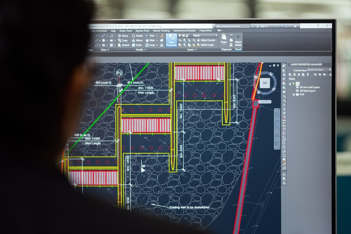
By default we deliver point clouds in E57 or RCP format. We also process the data into DWG (AutoCAD), RVT (Revit), IFC (open BIM) or 2D drawings. We deliver what your engineering team needs.
With the NavVis VLX combined with Leica control points we achieve an accuracy of 2 to 5mm, depending on conditions. For most industrial applications such as as-built documentation and clash detection, this is more than sufficient.
Yes. We model point clouds into Revit or Navisworks models. The level of detail (LOD) is matched to your project requirements, from basic geometry to fully detailed as-built models.
Traditional surveying captures individual points. 3D laser scanning captures millions of points per second, producing a complete spatial image. This is faster, more comprehensive and delivers data that remains useful later for new questions.
Yes. We are used to working at locations with high safety requirements, such as petrochemical plants and refineries. We work according to the applicable safety standards and are familiar with VCA-certified work environments (Dutch safety certification, equivalent to SCC).
“We are very satisfied with the dimensional control service across various projects. From the very first contact, communication has run smoothly.”
“Michael had everything worked out the day before and was able to come the very next day. Delivers good work and is professional. We are very satisfied.”
“The dimensional control service was excellent. The team delivered accurate and timely results, which kept the project running smoothly.”
Related services.
Dimensional Control
Have reference points set out so your contractor can start tomorrow. Aligned with your planning, accurate to the millimeter.
Drafting / CAD
Turn raw measurement data into usable drawings and 3D models. Receive your files in DWG, IFC or RVT, ready for engineering.
24/7 Monitoring
Keep watch over your project day and night without anyone on site. Immediate alerts on deviations, continuous insight into movement.
More about 3D Scanning?
We are happy to discuss the options for your project. Reach out to Michael for personal advice, no strings attached.
No-obligation advice on the approach for your project. Usually a response within 24 hours.